NREL National Solar Radiation Database (NSRDB) Data Viewer |
  
|
NREL National Solar Radiation Database (NSRDB) Data Viewer |
|
(Go directly to Importing NREL NSRDB viewer Data)
All the data are available for free through the Viewer and available in the NREL SAM CSV file format files:
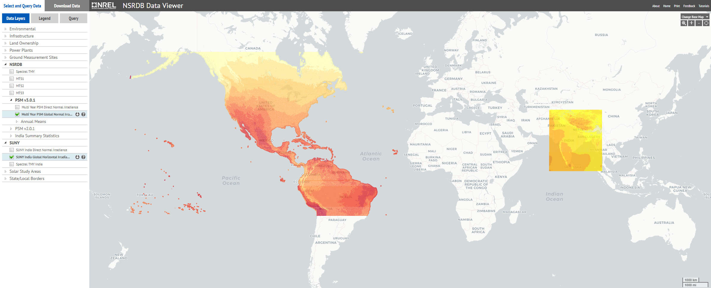
·PSMv3: 1998-2016 and TMY data : 30 / 60 minutes solar data derived from GOES satellites using NREL's PSM methodology (see below), 4x4km spatial resolution. The area covered is bordered by longitudes 175°W to 25°W, and by latitudes 20°S to 60°N.
·Suny (India) 2000-2014 and TMY data: 60 minutes solar data using the SUNY Semi-Empirical model based on Meteosat 5/7 satellites data, with a 0.1° resolution (roughly 10x10km). The area covered is bordered by longitudes 67°E to 98°E, and by latitudes 5°N to 38°N.
Details of the Method
·TMY data sets
TMY data sets are juxtapositions of months or periods of real data, chosen in the multi-year data set in such a way that they represent a typical 1-year period. Their intended use is for computer simulations of solar energy conversion systems and building systems to facilitate performance comparisons of different system types, configurations, and locations in the United States and its territories. Because they represent typical rather than extreme conditions, they are not suited for designing systems to meet the worst-case conditions occurring at a location.
·NREL Physical Solar Model
The Physical Solar Model (PSM) developed by NREL in collaboration with the University of Wisconsin and the National Oceanic and Atmospheric Administration (NOAA) computes global horizontal irradiance (GHI) using the visible and infrared channel measurements from the Geostationary Operational Environmental Satellites (GOES) system. PSM uses a two-stage scheme that first retrieves cloud properties and then uses those properties to calculate surface radiation. The cloud properties in PSM are generated using the AVHRR Pathfinder Atmospheres-Extended (PATMOS-x) algorithms. Using the cloud mask from PATMOS-x, and aerosol optical depth (AOD) and precipitable water vapor (PWV) from ancillary sources, the direct normal irradiance (DNI) and GHI are computed for clear-sky conditions using the MMAC model. For cloud scenes identified by the cloud mask, the Satellite Algorithm for Surface Radiation Budget (SASRAB) is used to compute the GHI. The DNI for cloud scenes is then computed using the DISC model.