Import TMY data from PVGIS or NSRDB |
  
|
Import TMY data from PVGIS or NSRDB |
|
Importing meteo data for geographical site creation
When creating a geographical site, after defining the latitude, longitude, altitude, time zone and site name, you can import meteo data from the PVGIS API or the NSRDB API.
For the import to work, you need to have a working internet access. Both of these import is automatic based on the coordinates of your site.
The data imported are in hourly values, the values are then averaged and displayed as monthly values.
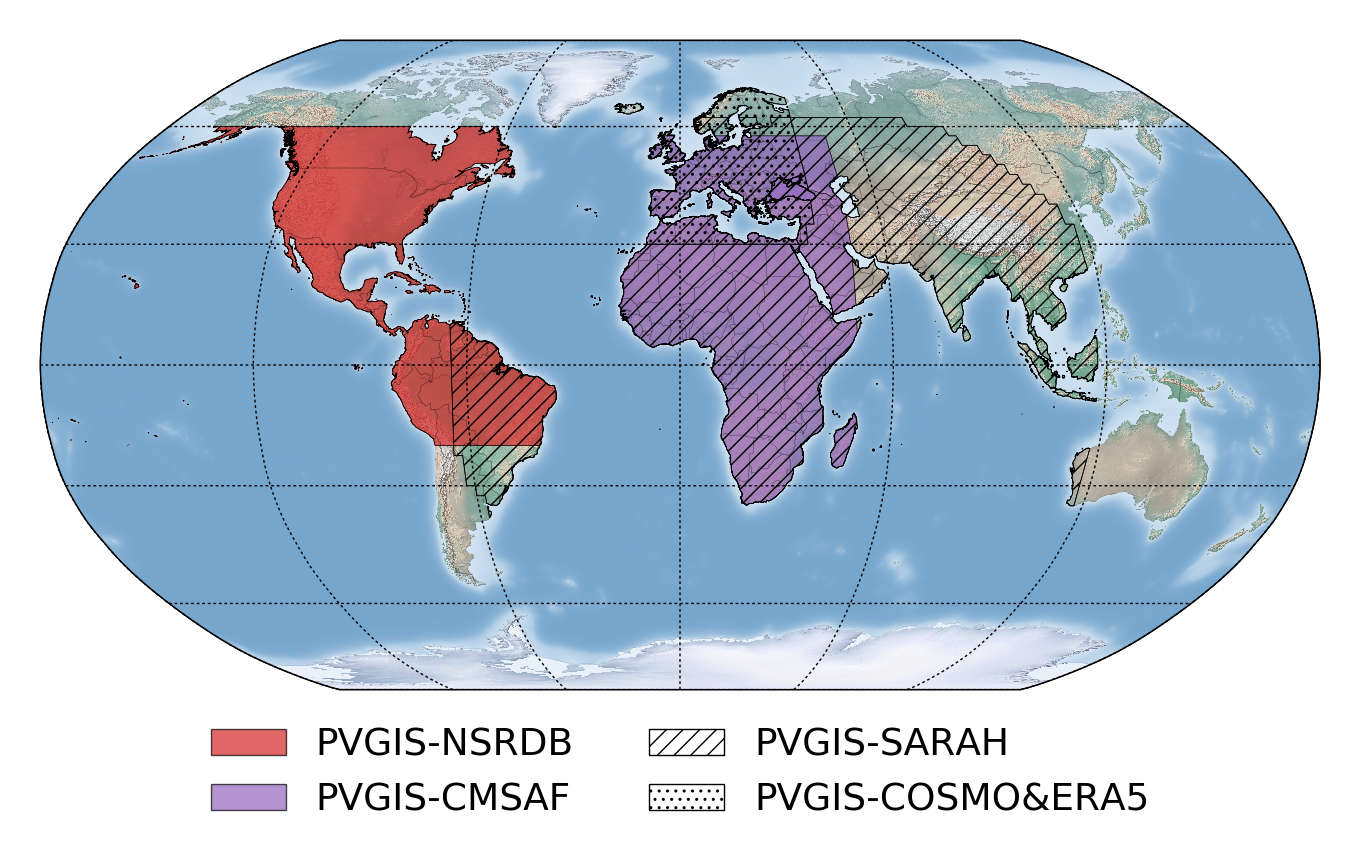
PVGIS TMY data
The PVGIS data available are TMY (Typical Meteorological Year) based on the most recent data reevaluation from the European Commission Joint Research Centre (JRC). The source of data depends of the geographical site you are creating below are the area covered by each source:
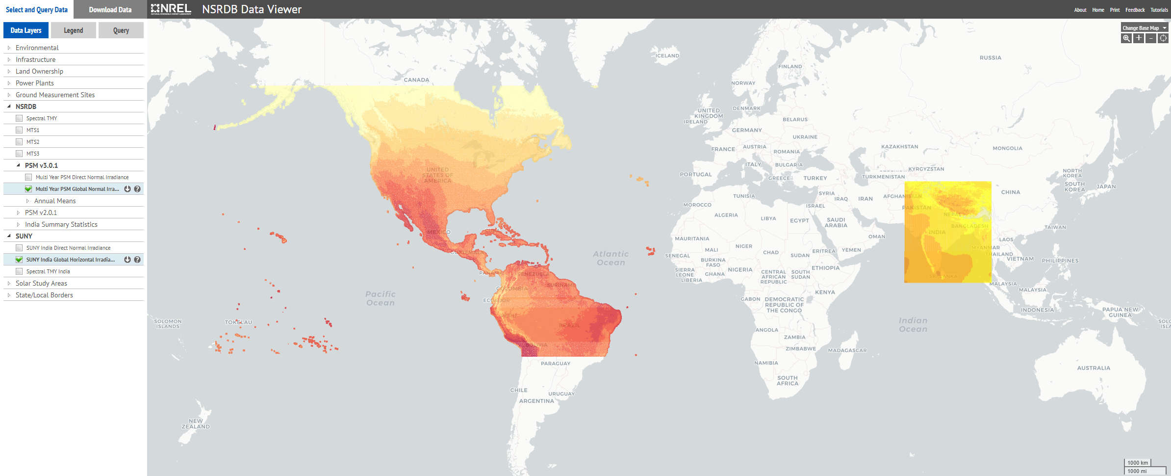
NSRDB TMY data
The NSRDB data available are TMY (Typical Meteorological Year) based on the most recent data from the NREL.